Ten Thousand Miles along the Yellow River
Not on view
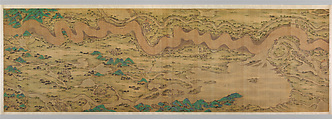
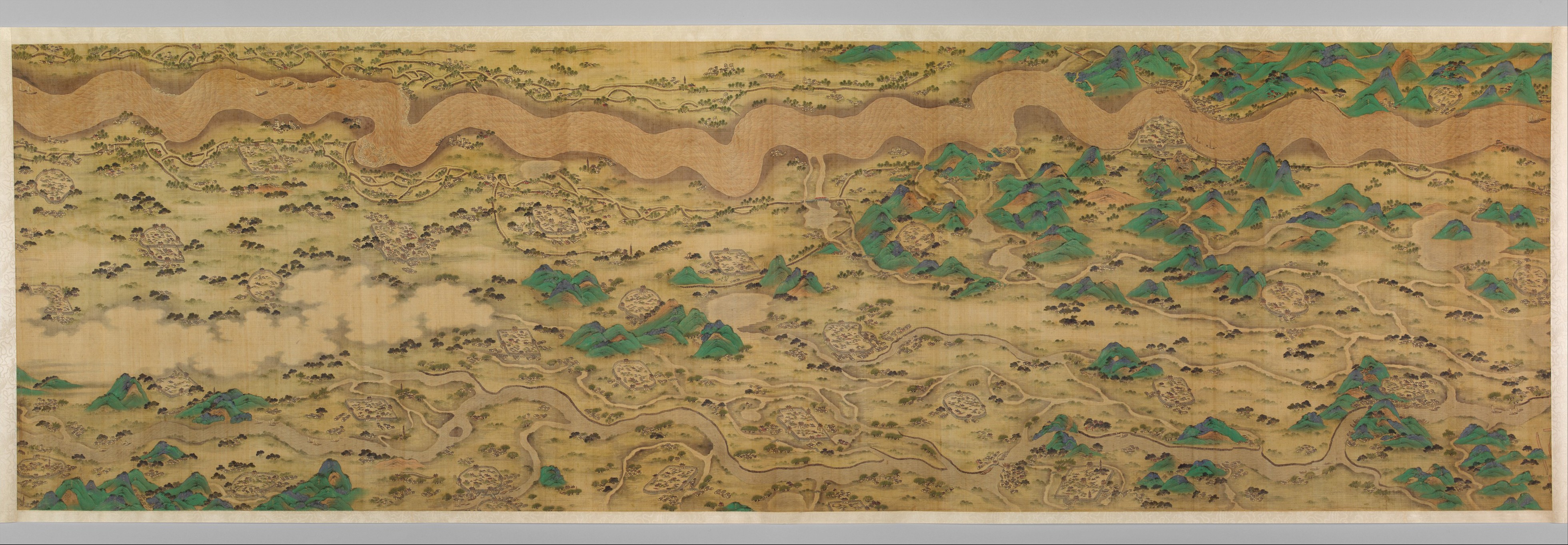
Given the constant threat of flooding from the Yellow River, the study and management of that river system was one of the highest priorities of the Qing court. This monumental map graphically illustrates the complexity of controlling the Yellow River's channel and its potential impact on the numerous towns and cities in its drainage area. Painted around the time that the Kangxi emperor (r. 1662–1722) engaged a team of Jesuit missionaries to conduct a comprehensive survey of his empire, the map reflects the highest level of indigenous mapmaking before the introduction of European techniques. Indeed, the map's appeal lies not in its cartographic accuracy but in its pictorial treatment of terrain features. To unroll the scrolls is to vicariously experience the drama of voyaging up the Yellow River from the East China Sea to the rapids of the Dragon Gate.
The map merges panoramic landscape painting and cartography: waterways are rendered in a planometric fashion (that is, they lie flat on the picture surface); mountains are depicted frontally; and architecture, notably walled towns and cities, are shown as isometric projections. There is no consistent use of foreshortening, perspective, atmospheric distortion, or diminution of scale to suggest spatial recession. One may speak of the bottom or top of the composition, but there is no measurable distinction between the foreground and the far distance. Nevertheless, the map is visually coherent, and its seemingly unbounded view of vast expanses enables the viewer to grasp far more than the eye could see in reality.
#7415. Ten Thousand Miles along the Yellow River
Due to rights restrictions, this image cannot be enlarged, viewed at full screen, or downloaded.

This artwork is meant to be viewed from right to left. Scroll left to view more.

