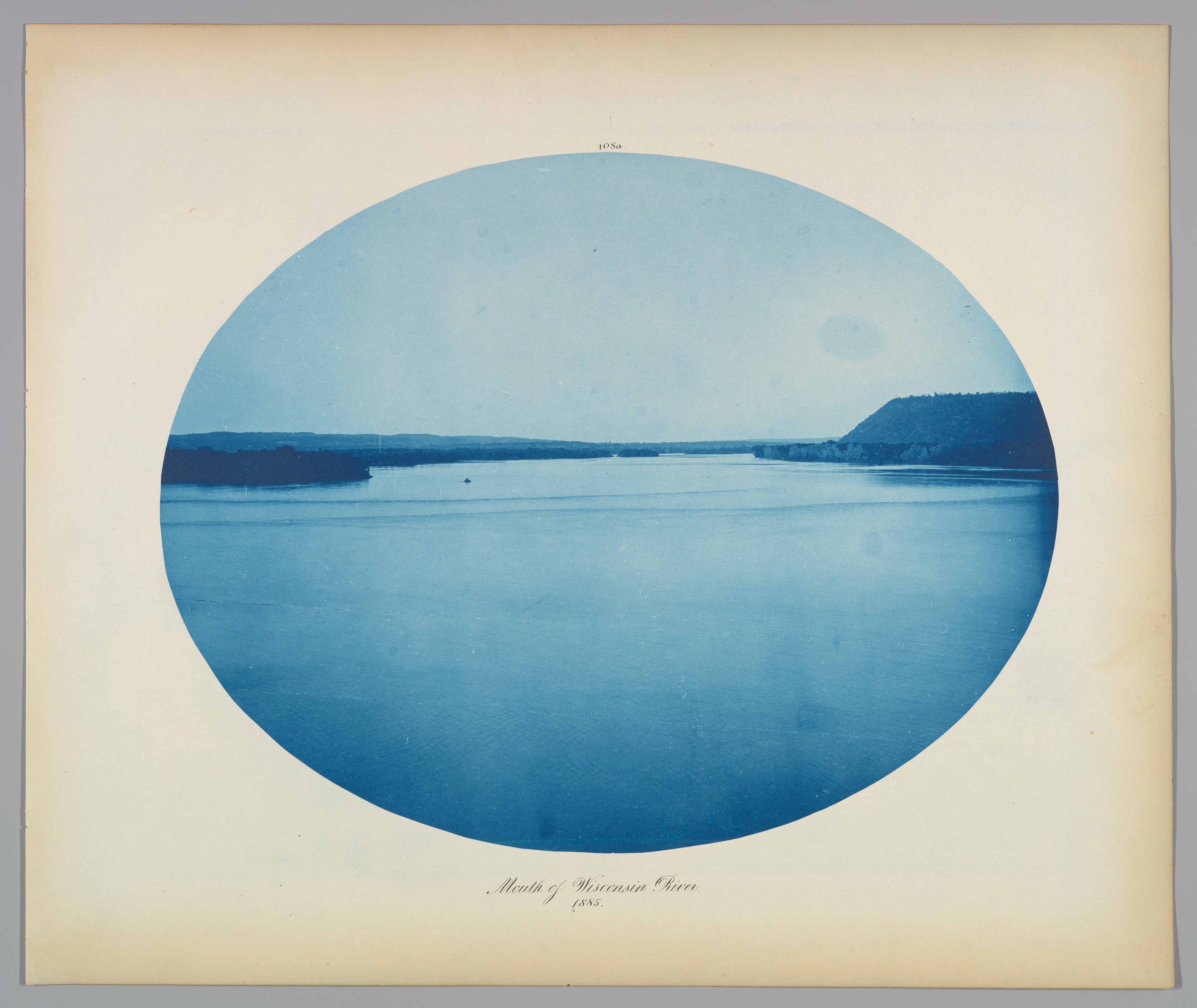
Mouth of Wisconsin River
Henry P. Bosse American, born Germany
Not on view
With the goal of developing the Mississippi River into a secure transportation route, the United States Army Corps of Engineers hired Prussian-born cartographer Bosse to map the upper portion of the waterway between Minneapolis and St. Louis. Over the course
of ten years, he documented its meandering path under the dome of the Midwestern sky. His choice of the cyanotype—the same process used until recently by architects to duplicate their line drawings—was likely one of economy, as the materials were readily available to draftsmen. While many of his photographs document the interplay between the natural and the manmade, in this tranquil image, Bosse emphasizes sky and water, evoking the immensity and utter expansiveness of a subject that seems to have no bounds.
Due to rights restrictions, this image cannot be enlarged, viewed at full screen, or downloaded.
