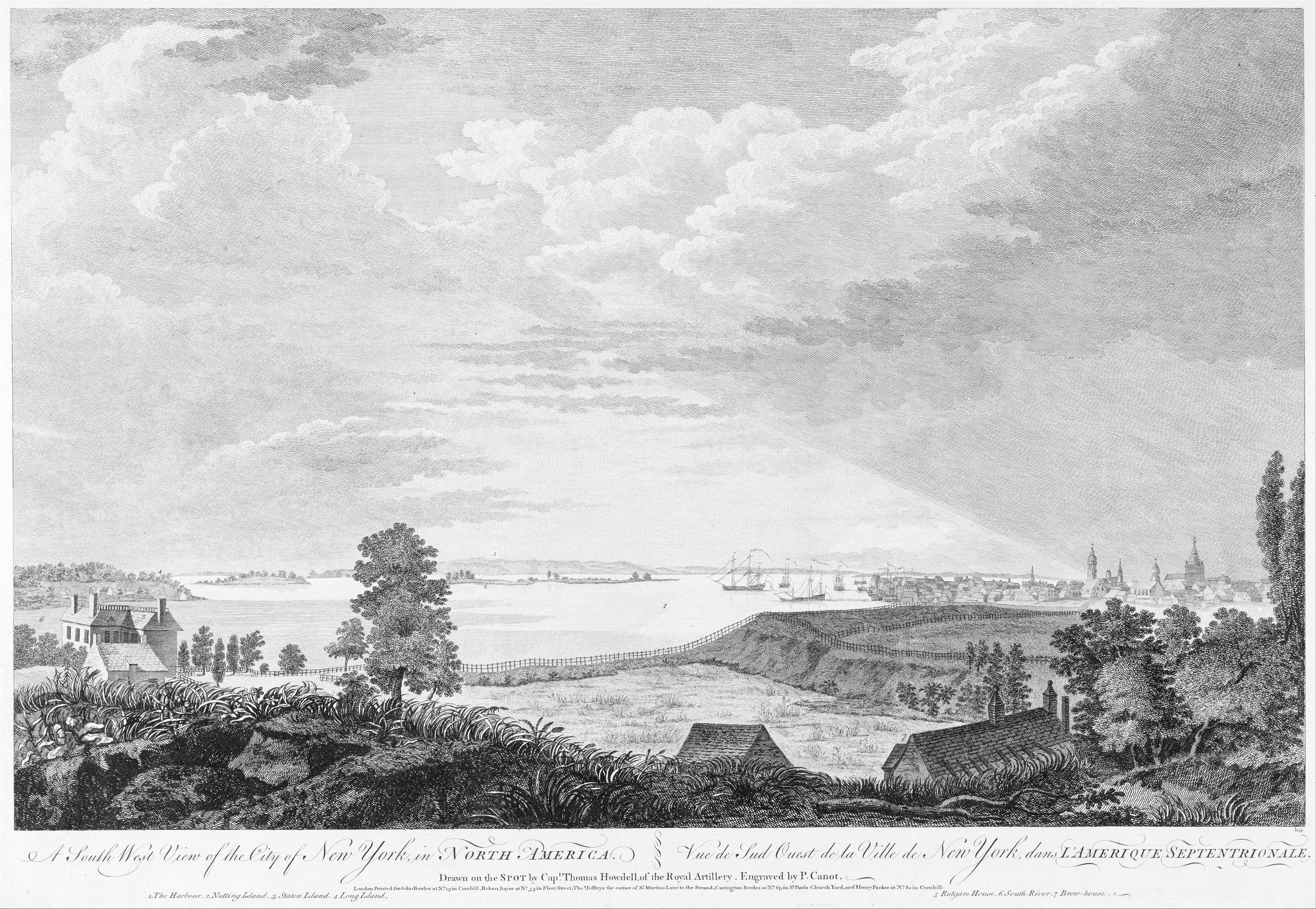
A South West View of the City of New York, in North America
Not on view
Published in London in 1768, this prospect of New York was made when the city was under British control. Pierre Canot based his engraving on a drawing that Thomas Howdell, a Royal Artillery captain, made about 1763. The view looks south from a point near the present intersection of Henry and Montgomery Streets on the Lower East Side. The hill in the foreground was called Mount Pitt. At left is the East River, with Nutting (now Governor's Island) and Staten Island in the distance. The city appears at right. In 1765 New York's population had reached about 12,500 and streets were being laid out as far north as Collect Pond, a primary water source near what is today Foley Square. Beyond were pleasure gardens and burial grounds then estates, farms, and villages.
Due to rights restrictions, this image cannot be enlarged, viewed at full screen, or downloaded.


