A Plan of the City of New-York & its Environs, to Greenwich, on the North, or Hudsons River, and to Crown Point on the East, or Sound River, Shewing the Several Street, Publick Buildings, Docks, Fort, & Battery, with the true Form & Course of the Commanding Grounds with and without the Town, Survey'd in Winter 1766-66 [The Montresor Plan]
Colonial upheaval following the Stamp Act of 1765 led the British commander in chief, Thomas Gage, to order a new plan of Manhattan. Fearing reprisals from angry locals, the skilled military engineer John Montresor surveyed the city secretly between December 1765 and mid-February 1766, then took his drawings to London to be engraved. This large-scale plan, published in 1768 to aid British control, offers a fascinating glimpse of colonial-era New York. Few streets are named, but a key allows us to locate churches, King’s College (later Columbia University), pleasure grounds, and breweries. The Jewish cemetery appears near the Bowery, and sites outside the city include the village of Greenwich and the Rutgers’ estate.
Artwork Details
- Title: A Plan of the City of New-York & its Environs, to Greenwich, on the North, or Hudsons River, and to Crown Point on the East, or Sound River, Shewing the Several Street, Publick Buildings, Docks, Fort, & Battery, with the true Form & Course of the Commanding Grounds with and without the Town, Survey'd in Winter 1766-66 [The Montresor Plan]
- Engraver: Peter Andrews (British, active 1762–82)
- Artist: After Captain John Montresor (British, Gibraltar 1736–1799 Maidstone, Kent)
- Dedicatee: Sir Thomas Gage (British, ca. 1780–1820)
- Publisher: Mary Ann Rocque (British, active 1760s)
- Date: 1768
- Medium: Etching and engraving; first state
- Dimensions: Sheet: 25 1/4 × 20 11/16 in. (64.2 × 52.5 cm)
- Classification: Prints
- Credit Line: The Edward W. C. Arnold Collection of New York Prints, Maps and Pictures, Bequest of Edward W. C. Arnold, 1954
- Object Number: 54.90.1719
- Curatorial Department: Drawings and Prints
More Artwork
A slider containing 5 items.
Press the down key to skip to the last item.
Press the down key to skip to the last item.
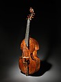
labeled Richard Meares
ca. 1680
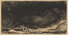
Rembrandt (Rembrandt van Rijn)
1658
Elizabeth Catlett
1952 (published 1968–70)
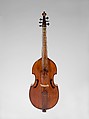
Attributed to Barak Norman
1692
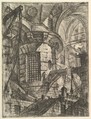
Giovanni Battista Piranesi
Publisher Giovanni Bouchard
ca. 1749–50
Research Resources
The Met provides unparalleled resources for research and welcomes an international community of students and scholars. The Met's Open Access API is where creators and researchers can connect to the The Met collection. Open Access data and public domain images are available for unrestricted commercial and noncommercial use without permission or fee.
To request images under copyright and other restrictions, please use this Image Request form.
Feedback
We continue to research and examine historical and cultural context for objects in The Met collection. If you have comments or questions about this object record, please contact us using the form below. The Museum looks forward to receiving your comments.