Plan of the City of New York and its Environs to Greenwich, on the North or Hudson's River, and to Crown Point, on the East or Sound River, Shewing the Several Streets, Publick Buildings, Docks, Forts & Battery . . . Surveyed in the Winter, 1775 [i.e. 1665] [the Montresor Plan]
Artwork Details
- Title: Plan of the City of New York and its Environs to Greenwich, on the North or Hudson's River, and to Crown Point, on the East or Sound River, Shewing the Several Streets, Publick Buildings, Docks, Forts & Battery . . . Surveyed in the Winter, 1775 [i.e. 1665] [the Montresor Plan]
- Engraver: Peter Andrews (British, active 1762–82)
- Artist: After Captain John Montresor (British, Gibraltar 1736–1799 Maidstone, Kent)
- Publisher: Andrew Dury (British, active 1742–78)
- Dedicatee: Sir Thomas Gage (British, ca. 1780–1820)
- Date: 1775
- Medium: Hand-colored engraving; second state
- Dimensions: plate: 25 1/2 x 20 3/4 in. (64.8 x 52.7 cm)
sheet: 29 3/4 x 21 7/8 in. (75.6 x 55.6 cm) - Classification: Prints
- Credit Line: Bequest of Charles Allen Munn, 1924
- Object Number: 24.90.1345
- Curatorial Department: Drawings and Prints
More Artwork
A slider containing 5 items.
Press the down key to skip to the last item.
Press the down key to skip to the last item.
![A Plan of the City of New-York & its Environs, to Greenwich, on the North, or Hudsons River, and to Crown Point on the East, or Sound River, Shewing the Several Street, Publick Buildings, Docks, Fort, & Battery, with the true Form & Course of the Commanding Grounds with and without the Town, Survey'd in Winter 1766-66 [The Montresor Plan], Peter Andrews British, Etching and engraving; first state](https://images.metmuseum.org/CRDImages/dp/web-additional/DP-44831-001.jpg)
Multiple artists/makers
1768
British
first half 18th century
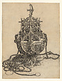
Martin Schongauer
After/with Georg Schongauer
1470–1491
Joseph Bradbury
ca. 1700
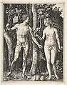
Albrecht Dürer
1504
Related Content
 Free to download
Research Resources
The Met provides unparalleled resources for research and welcomes an international community of students and scholars. The Met's Open Access API is where creators and researchers can connect to the The Met collection. Open Access data and public domain images are available for unrestricted commercial and noncommercial use without permission or fee.
To request images under copyright and other restrictions, please use this Image Request form.
Feedback
We continue to research and examine historical and cultural context for objects in The Met collection. If you have comments or questions about this object record, please contact us using the form below. The Museum looks forward to receiving your comments.