Survey of Sturgeon Creek, Maine
Anonymous, American, 18th century American
Not on view
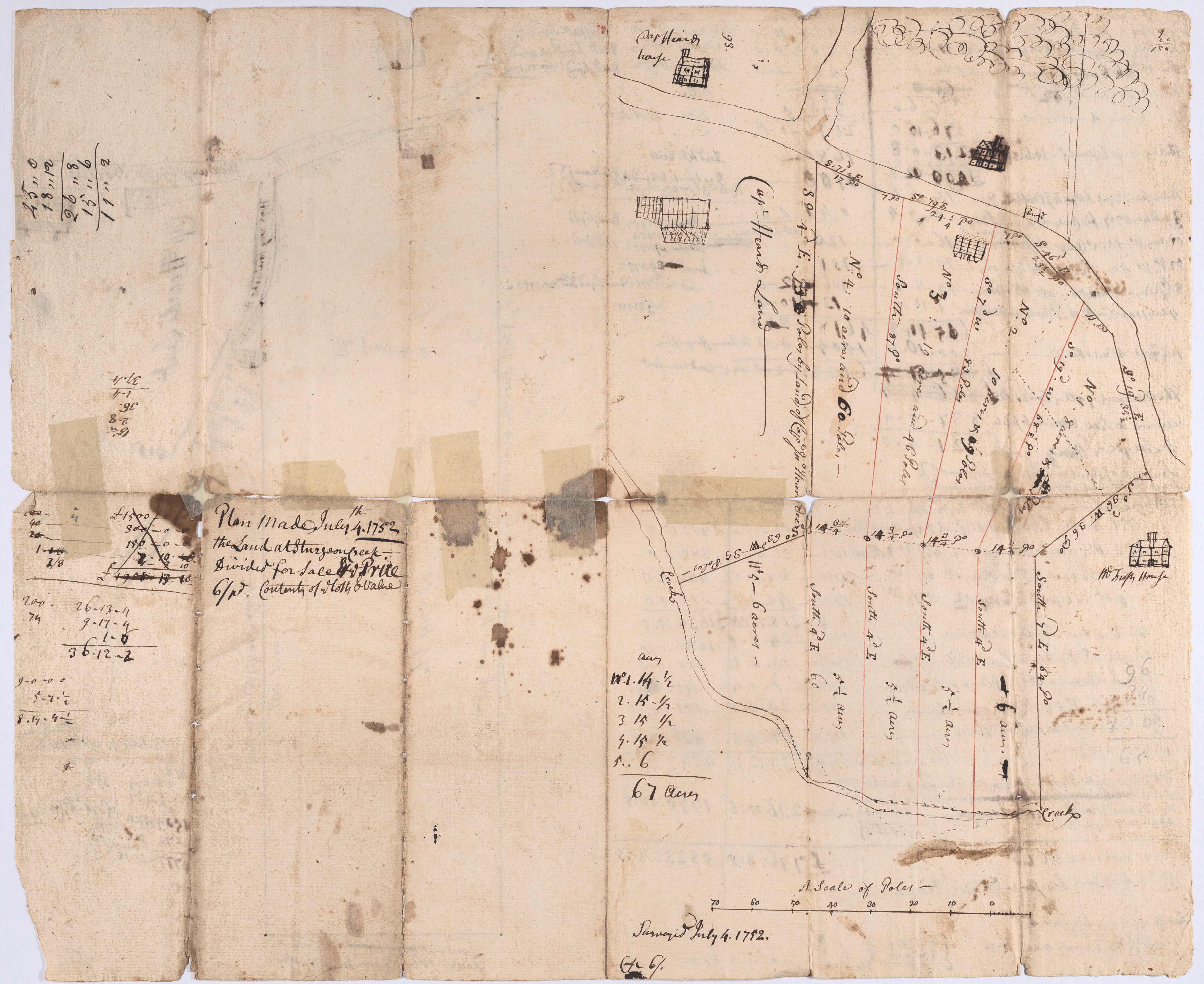
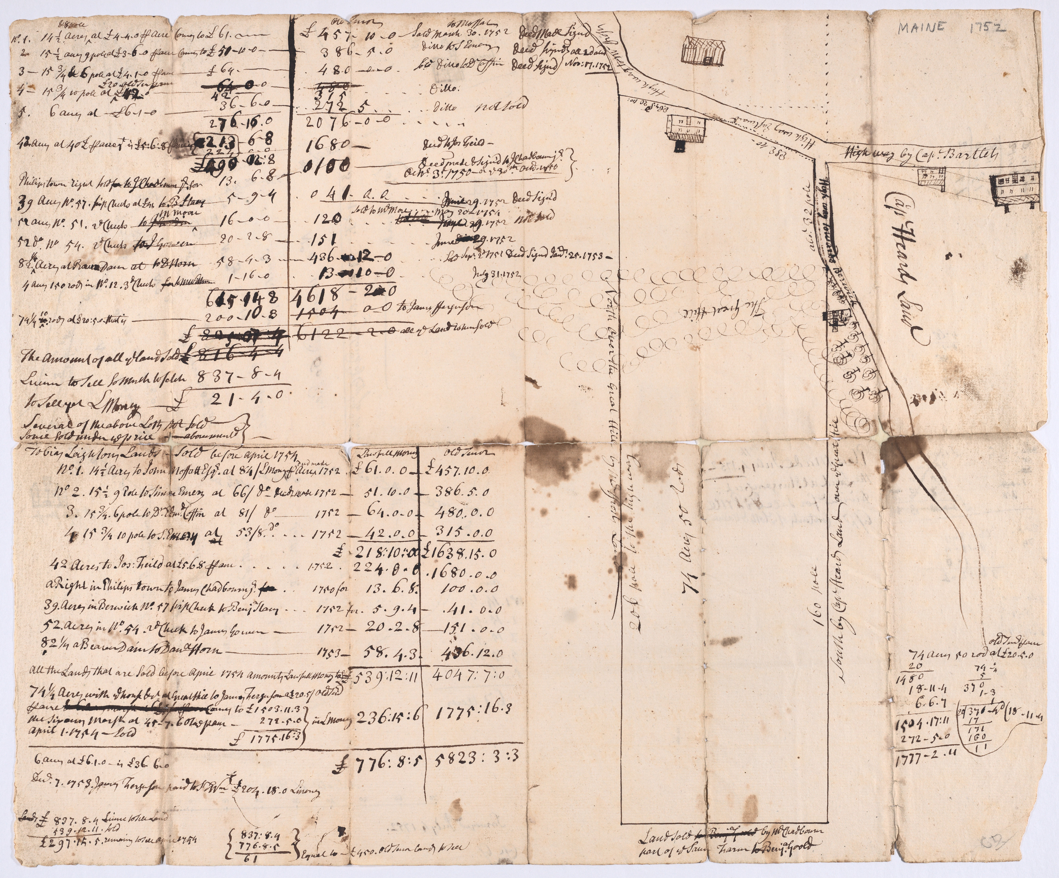
This sketch by an unknown draftsman and dated 1752 relates to land ownership at a Maine colonial settlement located south of Portland. Originally part of the Piscataqua Plantation, the area was known as Sturgeon Creek in the 1630s, renamed the parish of North Kittery in 1713, and finally incorporated as the town of Eliot in 1810.
Due to rights restrictions, this image cannot be enlarged, viewed at full screen, or downloaded.

This artwork is meant to be viewed from right to left. Scroll left to view more.


