A New and Correct Chart of the Coast of New England and New York, with Adjacent Parts of Nova Scotia and New Brunswick, from Cape Sable to the Entrance of Hudsons or North River, by Captain Holland (bottom half)
Artwork Details
- Title: A New and Correct Chart of the Coast of New England and New York, with Adjacent Parts of Nova Scotia and New Brunswick, from Cape Sable to the Entrance of Hudsons or North River, by Captain Holland (bottom half)
- Artist: Based on surveys by Samuel Holland (British, born Deventer, Dutch Republic 1764–1791 Quebec)
- Publisher: Laurie & Whittle (British, active 1794–1836)
- Date: 1794
- Medium: Etching and engraving
- Dimensions: Sheet: 21 in. × 56 13/16 in. (53.4 × 144.3 cm)
- Classification: Prints
- Credit Line: The Edward W. C. Arnold Collection of New York Prints, Maps and Pictures, Bequest of Edward W. C. Arnold, 1954
- Object Number: 54.90.1638(2)
- Curatorial Department: Drawings and Prints
More Artwork
A slider containing 5 items.
Press the down key to skip to the last item.
Press the down key to skip to the last item.
![Puss in Boots, an entertaining School-Piece: by Young Slyboots [School piece or Penmanship sheet], Laurie & Whittle British, Etching and engraving; late impression](https://images.metmuseum.org/CRDImages/dp/web-additional/DP-26613-001.jpg)
Publisher Laurie & Whittle
November 13, 1802
Joseph Bradbury
ca. 1700
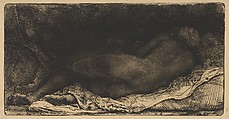
Rembrandt (Rembrandt van Rijn)
1658
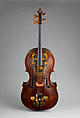
William Forster
1782
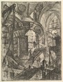
Giovanni Battista Piranesi
Publisher Giovanni Bouchard
ca. 1749–50
Research Resources
The Met provides unparalleled resources for research and welcomes an international community of students and scholars. The Met's Open Access API is where creators and researchers can connect to the The Met collection. Open Access data and public domain images are available for unrestricted commercial and noncommercial use without permission or fee.
To request images under copyright and other restrictions, please use this Image Request form.
Feedback
We continue to research and examine historical and cultural context for objects in The Met collection. If you have comments or questions about this object record, please contact us using the form below. The Museum looks forward to receiving your comments.