Parts of the Counties of Charlotte and Albany, in the Province of New York; being the Seat of War between the King's Forces under Lieut. General Burgoygne and the Rebel Army, from the London Magazine
London periodicals regularly reported on the American Revolutionary War (1775-81) and this map documents forts and sites of military signficance in upstate New York that related to British battles fought by General Burgoyne. When he took the supposedly impregnible Fort Ticonderoga from the Americans in July of 1777 without any resistance, rejoincing followed in Britain and consternation in Congress. This victory was, however, followed by a significant British defeats near Saratoga, in September and October 1777. Burgoyne's surrender to Washington was a turning point that brought France into the war on the side of the Americans. Ticonderoga appears near the top of this map, Saratoga at center and Albany at the lower edge.
Artwork Details
- Title: Parts of the Counties of Charlotte and Albany, in the Province of New York; being the Seat of War between the King's Forces under Lieut. General Burgoygne and the Rebel Army, from the London Magazine
- Engraver: Thomas Kitchin (British, Southwark 1719–1784 St. Albans)
- Printer: Robert Baldwin, London
- Date: 1778
- Medium: Etching and engraving
- Dimensions: Image: 9 3/4 × 7 3/8 in. (24.8 × 18.7 cm)
Sheet (trimmed within plate line at left and bottom): 10 3/8 × 8 1/8 in. (26.4 × 20.7 cm) - Classification: Prints
- Credit Line: Gift of Charles Allen Munn, 1924
- Object Number: 24.90.1290
- Curatorial Department: Drawings and Prints
More Artwork
A slider containing 5 items.
Press the down key to skip to the last item.
Press the down key to skip to the last item.
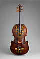
William Forster
1782
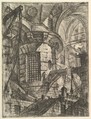
Giovanni Battista Piranesi
Publisher Giovanni Bouchard
ca. 1749–50
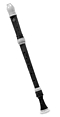
Joseph Bradbury
ca. 1700
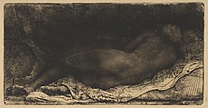
Rembrandt (Rembrandt van Rijn)
1658
British
first half 18th century
Research Resources
The Met provides unparalleled resources for research and welcomes an international community of students and scholars. The Met's Open Access API is where creators and researchers can connect to the The Met collection. Open Access data and public domain images are available for unrestricted commercial and noncommercial use without permission or fee.
To request images under copyright and other restrictions, please use this Image Request form.
Feedback
We continue to research and examine historical and cultural context for objects in The Met collection. If you have comments or questions about this object record, please contact us using the form below. The Museum looks forward to receiving your comments.